(Or San Angelo Trip Part I)
On the 10 o’clock news I hear the weatherman say “And today in San Angelo it hit 100 degrees” and i see the name San Angelo on the big televised map of Texas. I have seen this name for years, but it meant nothing to me. I had never been there. I didn’t know anyone who lived there. And then one day, on Facebook, I saw a post about the San Angelo State Park. The poster had gotten some nice bird photos there. It was Spring, and I thought: “Road Trip.”
San Angelo is 205 miles to the northwest of Austin. We drove through rolling hills and interesting towns, the elevation gradually rising with each mile. The state park is on the outskirts of San Angelo. It has 7,677 acres and is a fairly new state park, having opened in 1995. There is a north shore area and a south shore area with a large reservoir made from damming up the Concho river. Check out the website for more information:
https://tpwd.texas.gov/state-parks/san-angelo

Here are just a few of the other things we saw during our all day visit:

Texas Longhorn Cattle

American Bison

Blooming Mesquite

Prickly Pear Cactus And Daisies
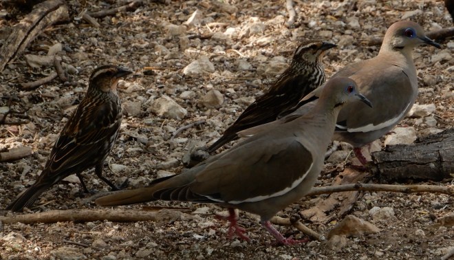
Female Red Wing Blackbirds and White Wing Doves Up Close At The Bird Blind

Turkeys

Scissortail Flycatcher
And as we neared the park exit…
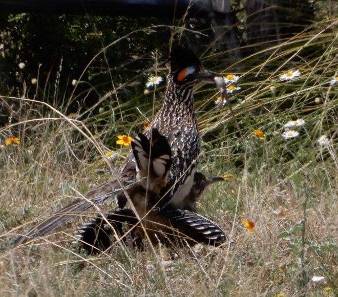
Road Runners Mating…note the lizard in the male’s beak. When they separated he still had the lizard…maybe to attract another mate?
We also saw deer and ground squirrels and a fox. And we saw other unidentified birds that I didn’t get shots of. This is a wonderful place and I recommend it to all who love spending time in the great outdoors. Now, when I see the name on the map, it will bring back the happy memories of all that I saw.
